ArcGIS Products
A collection of projects using ArcGIS Products especially apps.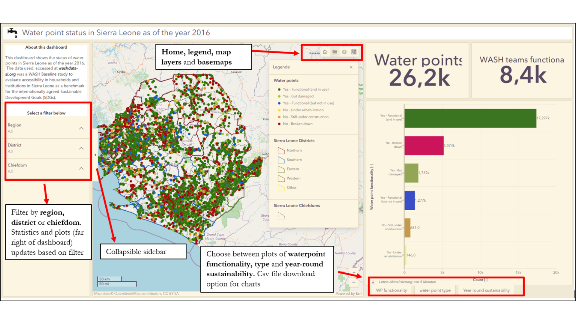

A collection of projects using ArcGIS Products especially apps.
This folder holds a collection of tasks using python to automate workflows, or create custom apps to increase workplace efficiency. 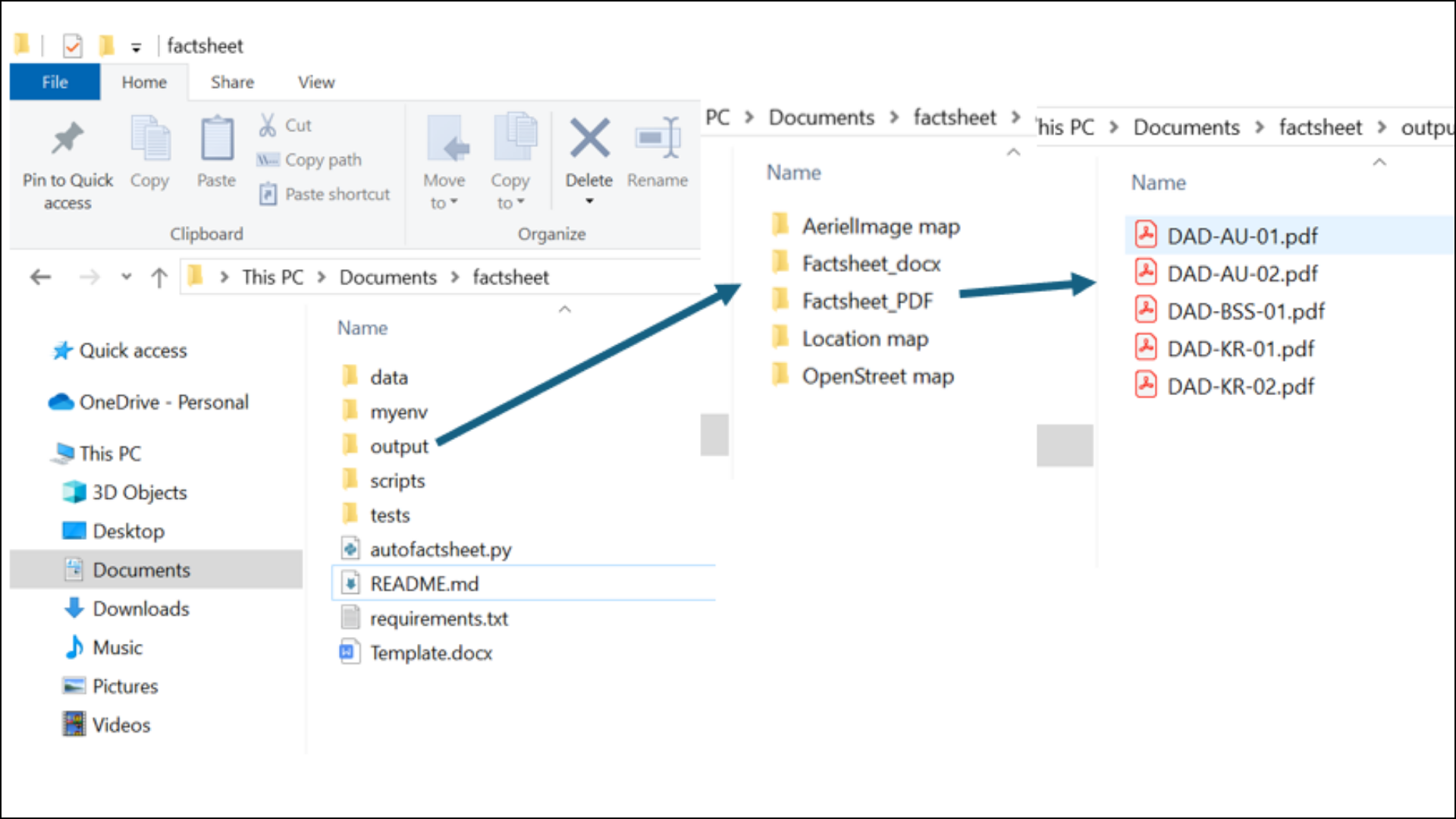
This folder is a documentation of my Master’s thesis titled: Geogenic radonpotential (GRP) mapping of Hessen using Machine Learning Technique 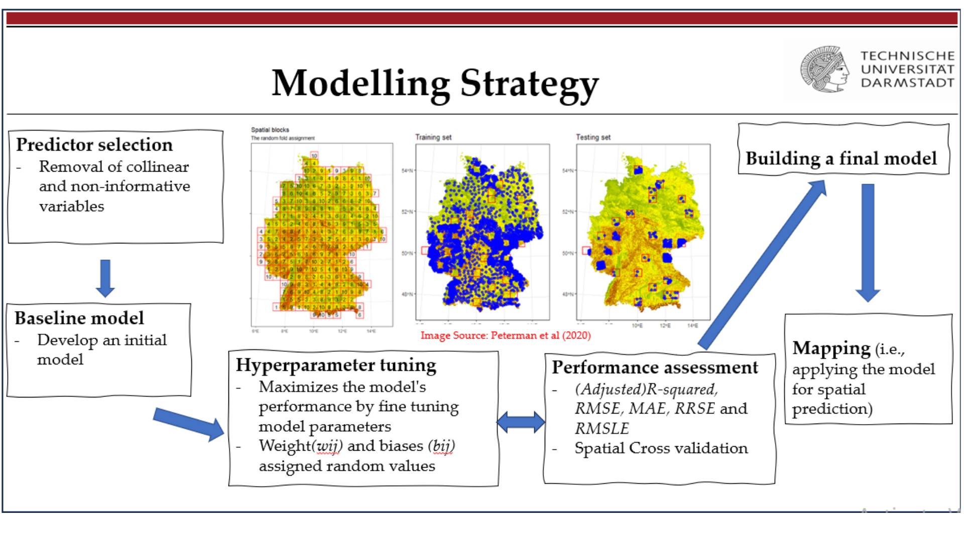
This folder includes GIS projects instructed by the Geoinformation Science Group at Technische Universitaet Darmstadt, done during my Master’s training 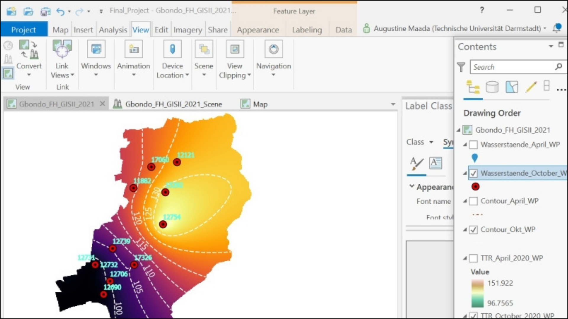
This folder includes projects and solutions developed using programming tools. Tools used are Google Earth Engiene for LULC classification, html,css and Javascript for web mapping, Python and associated libraries for processing and visualization tasks, and PostGRE-SQL/PostGIS for database design and management. 
This folder is a collection of projects that leverages Data Science and Machine Learning to solve real world problems.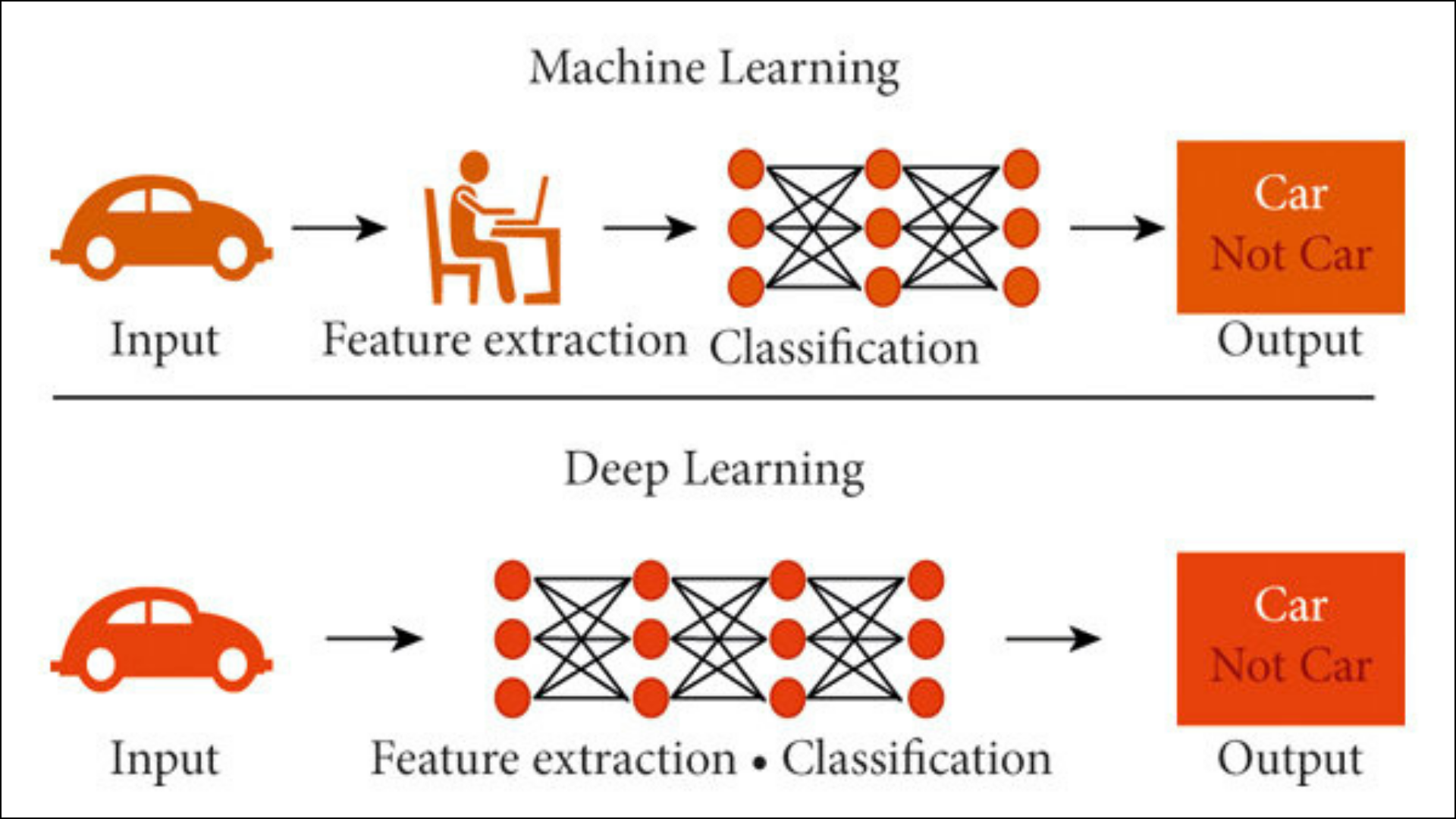 Image source: https://www.turing.com
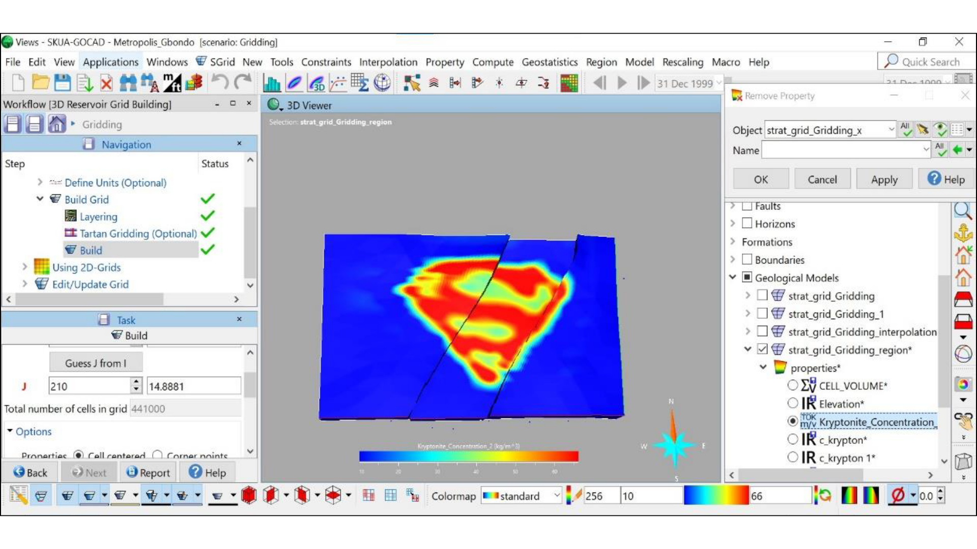
This repository includes course tutorials from the Geoinformation science group at TU Darmstadt, personal projects, and conceptual ideas using softwares and programming for 3D modelling, subsurface properties estimation and fluid flow. .